MarineTraffic for Windows

Description
MarineTraffic is a multifunctional information and reference service that allows and track the location of ships and ships on a global map using Automatic Identification System (AIS) technology, and in advance estimate the commercial potential of routes laid on a virtual canvas.
Depending on the required functionality, the required subscription option also changes: developers give out basic features to observers in free mode, without payments and restrictions, but specialists will have to choose a tariff plan for $ 30 or $ 60.
MarineTraffic Features
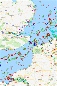
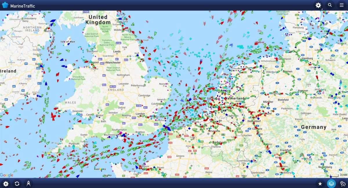
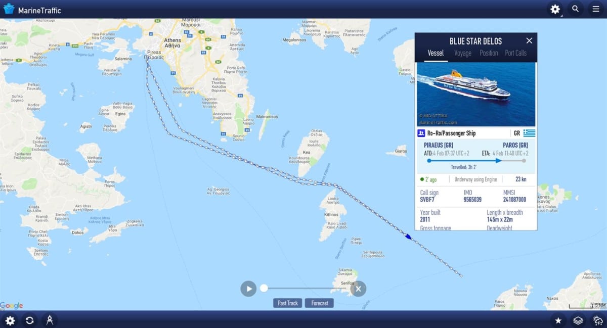
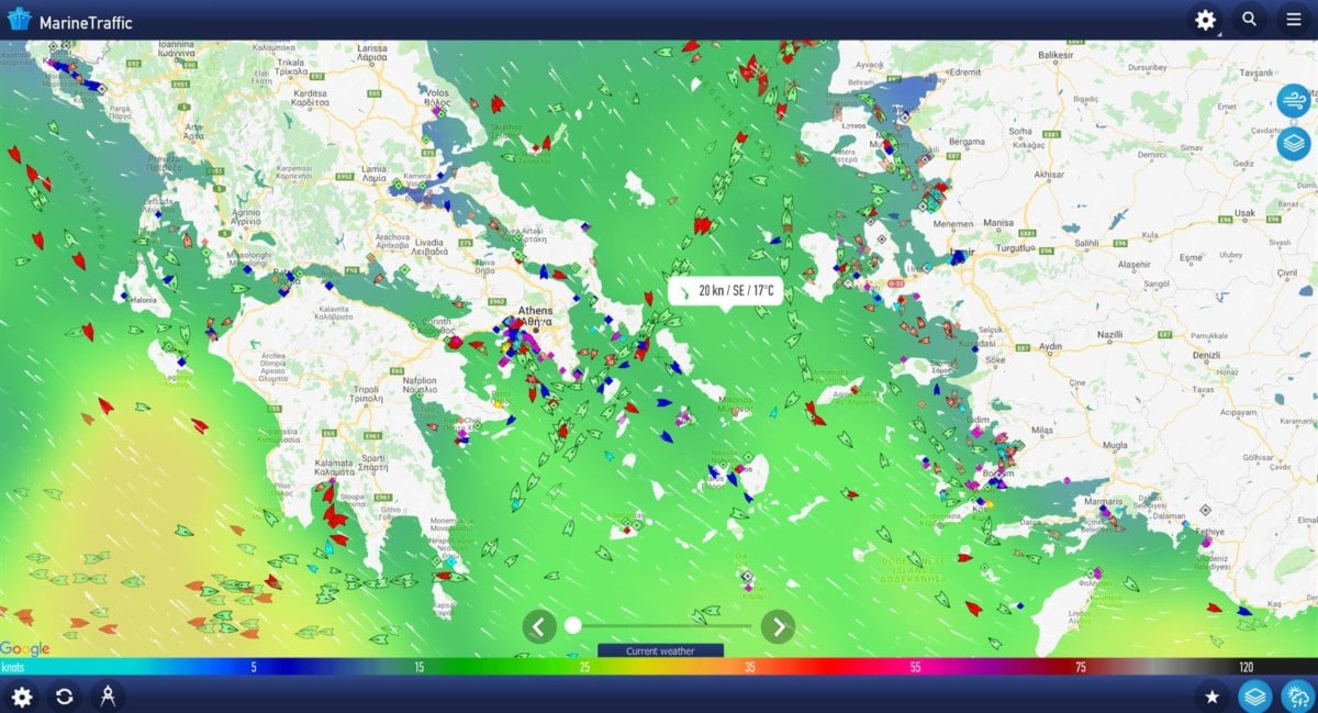
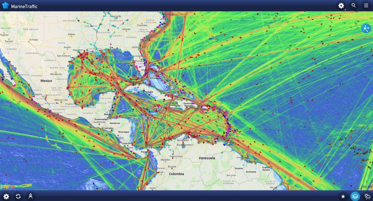
- Map . MarineTraffic developers offer real-time tracking of ports, cargo ships, tankers, passenger liners, yachts and navigation through a global map that is updated every 15-20 minutes. In addition to interactive presentation (for each separate category of vehicles – non-standard icons; and the color of virtual ships also displays the current “mode” – an arrow will show the direction, and a diamond will confirm a temporary stop with an “anchor”) information, the authors also took care of the settings. The map is easy to display the current weather (wind to snow and water temperature), traffic density and even the route for personal travel on the map. The system will calculate the necessary stops, suggest the cost of parking and even calculate the fuel spent in the MarineTraffic Ship.
- Hints . Instructions for beginners, although not needed, are still provided. The standard briefing will help you understand the interface, remind you how to navigate the menu, where to select the language and how to apply the filtering available in the search to filter out unnecessary vessels, the movement of which through the AIS system in MarineTraffic is not currently necessary to know. If after reading all the tips and instructions, the questions have not disappeared, no one bothers to contact the “Help Center”: there are both important recommendations and links for contacting technical support.
- Localization . The MarineTraffic service is still not available in Russian. The translation is still superficial and suffers from inaccuracies, which is why you have to leave the map with the RU option, but the rest of the interface elements are already returned to the standard form – in English. However, the developers are already trying to fix the situation – it’s a pity that updates appear less often than we would like.
- Approach . You can track the ship’s position in real time via MarineTraffic in different ways – there is a separate field with filters, and a section with the names of individual ports. And also – the panel with “Favorites” is opened, where it is easy to store only information on only certain ships, excluding other options. This customization principle can save you a lot of time!
Searching for vessels in real time in MarineTraffic is implemented in several ways. If the approximate location of a yacht, ship, tanker or liner is known, then it is easy to find the information you need directly on the map, zooming in on the image and leveling with the nearest land-like “limiters”. If the details are not enough, then MarineTraffic provides a free search with a bunch of filters.
You can enter the name of the vessel, port, search area, approximate time of departure or arrival at a certain port. The more data is added, the higher the chances of finding the desired result in a few seconds. Past again? It’s time to go over additional coordinates: flight, status, capacity, year of construction, maximum length – with a strong desire to “catch” on a suitable ship, it is still quite possible!
Additional Information
- License Paid
- OS Windows 10
- Category Maps & Navigation
- Developer marinetraffic.com
- Content Rating 3+